Monday 12th August
We were all up early and on the road by 5:30.
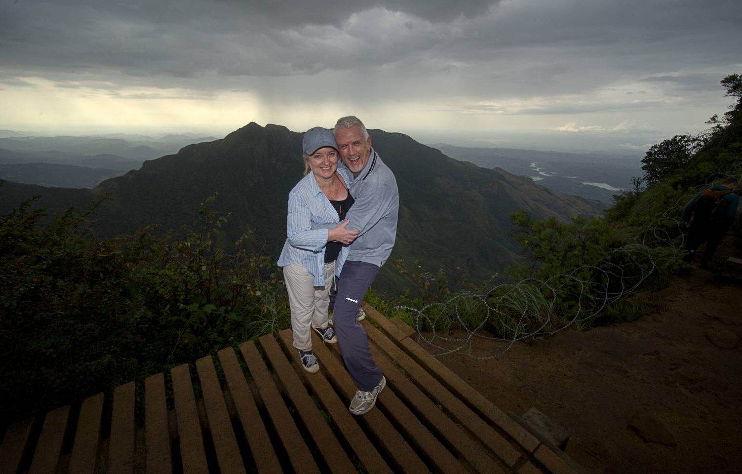
Everything we had read about the walk to World’s End said “Be there EARLY”. World’s End is a lookout on the edge of an 800 metre precipice. And apparently, it has a habit of only clearing briefly in the morning, before clouding over again.
We were the first car at the gate at 5:55. At 6:00, the Ranger came, took our money, issued our tickets, and we were off on the 5 km drive to the car park. Naturally, we were the first ones there also (although, that was not a given, as there is a secondary entrance to the park). We grabbed our respective backpacks, and headed down to the security checkpoint where plastic labels on drink bottles were removed. All bags were also checked for other disposable plastics. Once cleared, we were off on the 8km loop!
About 500 metres down the track, you come to a junction where you can make the decision on whether to do the loop clockwise or anti-clockwise. Clockwise is the preferred choice, as it is only 3 km to World’s End that way. Then, when you leave World’s End, it’s a further 3 km to Baker’s Falls, and then 2 km back to the car park.
As well as the aforementioned potential for the view to be clouded over, there is also the issue of overcrowding at the lookout. So we headed straight for World’s End. When we got there, you couldn’t see anything but cloud. Just as we were starting to think “Well, this sucks”, a small gap in the clouds appeared and we could see a mountaintop off in the distance.
And within 30 seconds, it had completely cleared.
And the view was truly one of THE greatest vistas I have ever seen on this planet. I’ve seen photos of other locations, but for “in the flesh”… this tops my list so far. You can look down into the valley below and see houses which look absolutely tiny. And you can look off into the distance and see Ude Walawe Reservoir, which is easily 40 km away to the south!
Within a couple of minutes, the next couple of hikers joined the 4 of us.
And not long after that, more arrived.
Within 5 mins, there was about 20 people there.
1 shot a couple of multi-image panoramas, and a bracketed set (from which to create an HDR image… with any luck, that HDR image will accompany this post).
And within another 3 minutes, the clouds closed in, the heavens opened up, and we decided it was time to make tracks for Baker’s Falls.
For the entirety of that 3 km walk, it rained. Most of the time lightly, some of the time, quite monsoon-like!
And 90% of that leg was out in the open with no canopy from the trees.
By the time we got to the falls, all 4 of us were drenched.
I really wanted to take my time setting up a good composition of the falls. I had plans of doing a long exposure with a 10 stop ND filter. But it was coming down hard, and we all wanted to get back to somewhere dry.
On top of which , I couldn’t swap lenses in the pouring rain, I didn’t want to muck around with filters which would have got rain spots on them as soon as I took them out of their cases… it was all just working against me.
So, I set up on the tripod, ripped off one quick shot at 1/5th of a second, packed up, threw my now-drenched backup onto my back, and we started off on the final 2 km leg back to the car.
As we neared the car park, we were amazed to see people starting out on the walk in thongs (“flip flops” for the non-Aussie reader)! This is a walk where you are constantly losing grip on wet rocks. I can only imagine how many people ended up with cuts to their feet from sliding around on wet rubber.
When we got back to the car, we all changed into dry clothes, and then it was back into the car and on the road to Nuwara Eliya and Kandy.
We dropped Duncan and Liz at the railway station in Kandy, then headed off to find our hotel.


